|


SUFFOLK COUNTY
|
|
Bay Shore Fire Tower
Location: Near Sweenydale Ave, east of Fifth Ave in the community of Brentwood.
Status: Removed.
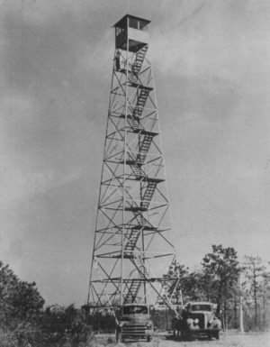 The
first and only structure at Bay Shore, more commonly referred to as
Brentwood, was an 80' Aermotor LS40 tower erected by the Conservation
Department in 1948. It was located on Fifth Avenue near Brentwood Road,
in the community of Brentwood, at a sand pit on Department of
Transportation property. The
first and only structure at Bay Shore, more commonly referred to as
Brentwood, was an 80' Aermotor LS40 tower erected by the Conservation
Department in 1948. It was located on Fifth Avenue near Brentwood Road,
in the community of Brentwood, at a sand pit on Department of
Transportation property.
The tower was operated from 1948 until it was closed
in 1959. Due to the vastly increasing population and industrial growth
on Long Island, the large number of well equipped volunteer fire
departments and the decreasing acres of woodlands, it was decided by
the Conservation Department to curtail its forest fire control
activities.
Effective September 1, 1959, the Conservation
Department withdrew from active participation in forest fire control in
Nassau and Suffolk counties on Long Island, thereby transferring this
responsibility to the town supervisors and closing all of the active
fire towers. This structure was removed in 1960.
|
|
Camp Upton Fire Tower
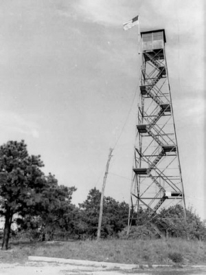 Location:On what is now Brookhaven National Laboratory property 3 1/2 miles northeast of Yaphank. Location:On what is now Brookhaven National Laboratory property 3 1/2 miles northeast of Yaphank.
Status: Removed.
The structure at Camp Upton, a United States Army
installation, was a 60' Aermotor LS40 tower erected by the Conservation
Department in 1932.
In addition to the steel tower, a wooden tower at
Camp Upton was also used by the state for fire observation purposes. On
the 7 1/2 minute USGS map there are two "lookout tower" notations in
the vicinity of Camp Upton. The northerly site is the former location
of the steel tower, while the southerly site is the location of the
wooden tower that was also utilized. The concrete footers still remain
at the northerly site and the former Fire Warden Larry Paul had first
hand knowledge of the wooden tower as he had occasion to visit it
before it was closed.
The towers were closed in 1953 and removed in 1955
or 56 by the new landowner, the Brookhaven National Laboratory, who
took over the property from the US Army. |
|
Central Islip Fire Tower
Location: Behind Wohlfarth's Gas Station on the Motor Parkway and Wheeler Road in Central Islip.
Status: Removed.
Initially, the tower in Central Islip was likely the
lower portion of the Oakdale tower that once stood on the South Side
Sportsman's Club, now the Connetquot River State Park at Oakdale. This
tower was used to release pheasants until a state law was passed which
prohibited the practice. Some say this consisted of forcing the birds
off the top of the tower so the "sportsmen" on the ground could shoot
them as they flew down. The tower was operated on the Club property
from April through June of 1921 by one, George Collins of Central
Islip.
In early 1922, the Sportsmen's Club
offered to donate the tower to the Town of Islip to be erected and
operated as a forest fire observation station. Fire Warden Jack
Wohlfarth and District Forest Ranger Clarence Dare requested that the
Islip Board of Supervisors accept the gift and authorize the moving of
a tower. This request was endorsed by Superintendent of Forests William
G Howard of the State Conservation Commission, who expressed the
opinion that the tower would be very valuable in helping the fire
wardens to locate and deal with incipient fires. Superintendent Howard
declared that the Town of Islip was far ahead of most of the towns of
the State in the matter of forest fire prevention and urged that the
good work be continued.
Central Islip Tower was operated by
the Conservation Commission during portions of 1922 and 23 reporting 28
fires in 1922 and 62 in 1923. A search of the archived payroll records
for that period showed that the State paid Bob Wohlfarth to operate the
Central Islip Tower in April, May and June of '23 and Jack Wohlfarth
for September and October of '23. The tower then closed but the
structure remained on the Wohlfarth property.
In 1933, Robert Wohlfarth, son of
Jack, and Central Islip fire warden, filed a petition with the Town
Board, asking that the 70-foot fire tower in the yard of his late
father's home be moved to his own back yard so that he might be further
enabled to watch for forest fires. The tower was used by his father,
now deceased, when he was fire warden. No record can or could be found
to verify any such action by the Town was ever taken.
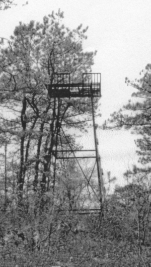 At
some later date, the 20 foot top section was relocated a short distance
off an old dirt road just north of Motor Parkway about 1/4 mile east of
Colonie Hill. At the time this photo was taken, the tower was unsafe to
climb, but a good view of the northeast interior of Smithtown could be
had from its base at that time according to a Greg Gottlieb, Fire
Marshal with the Hauppauge Fire District and Larry Paul, a former fire
warden and fire tower supporter and enthusiast. At
some later date, the 20 foot top section was relocated a short distance
off an old dirt road just north of Motor Parkway about 1/4 mile east of
Colonie Hill. At the time this photo was taken, the tower was unsafe to
climb, but a good view of the northeast interior of Smithtown could be
had from its base at that time according to a Greg Gottlieb, Fire
Marshal with the Hauppauge Fire District and Larry Paul, a former fire
warden and fire tower supporter and enthusiast.
All that now remains on site are some pieces of twisted and rusted metal.
|
|
Clock Tower
Location:On the former "Wheatley Estate" of Edwin Morgan III at the end of Clock Tower Road in Old Westbury, LI
Status: Removed.
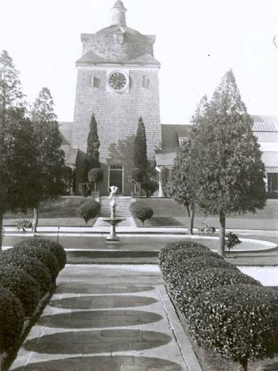 The
observation station named "Clock" was only used for part of one year.
New research revealed it was very likely on the "Wheatley Estate" of
Edwin D. Morgan III, grandson of a past NY Governor. The clock tower
image included is taken from the website "OldLongIsland.com", and was
located on a high hill between Harbor Hill and High Hill, about eleven
miles west of the Dix Hills. The tower has a room above the clock with
windows to all four directions, and was of sufficient height to offer a
reasonalbe view of the surrounding area. The
observation station named "Clock" was only used for part of one year.
New research revealed it was very likely on the "Wheatley Estate" of
Edwin D. Morgan III, grandson of a past NY Governor. The clock tower
image included is taken from the website "OldLongIsland.com", and was
located on a high hill between Harbor Hill and High Hill, about eleven
miles west of the Dix Hills. The tower has a room above the clock with
windows to all four directions, and was of sufficient height to offer a
reasonalbe view of the surrounding area. Additional evidence lies in the fact that the estate lies at the end of Clock Tower Road.
|
|
Dix Hills Fire Tower
Location: Dix Hills - South of Vanderbilt Parkway and west of Deer Park Avenue.
Status: Removed.
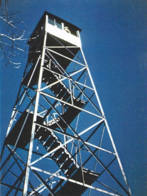 Dix Hills first appeared on the table of active observation stations in 1922. Dix Hills first appeared on the table of active observation stations in 1922.
The 60' Aermotor LS40 steel tower was
completed very early in the spring of 1924 by the Conservation
Commission. Funds for the station were provided by an interested
landowner in its vicinity.
The construction of Bay Shore and Kings Park towers
made it possible to close and remove Dix Hill in 1948. This structure
was removed and was destined to be erected at a new location four miles
to the west known as West Hills. These plans never materialized. In the
winter of 1948-49, it was taken to Saranac Lake to be used for spare
parts.
|
|
Flanders Hill Fire Tower
Location: Flanders Hill - 3 miles southeast of Riverhead.
Status: Removed.
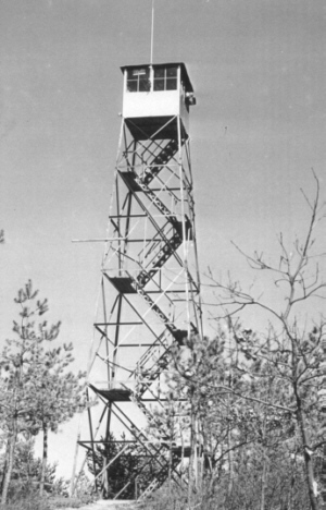 The
structure on Flanders Hill was a 47' Aermotor tower constructed by the
Conservation Commission in 1918 and was operational in 1919. The
structure on Flanders Hill was a 47' Aermotor tower constructed by the
Conservation Commission in 1918 and was operational in 1919.
The tower was operated from 1918 until it was closed
in 1959 when the Conservation Department withdrew from active
participation in forest fire control activities on Long Island.
An article tells of a serious fire in
the area of Flanders Hill that was initially caused by an automobile
that burst into flames on a road about a mile north of Riverhead. The
car was reduced to a mass of twisted metal from which flames spread to
nearby forest, leaves and underbrush and were carried by rising gales
to the outskirts of Quogue. The territory covered by the fire extended
from between one and two miles north of Riverhead to the outskirts of
Hampton Bays. The fire tower on Quogue Plains, maintained by the State
for discovering the beginnings of forest fires, was entirely surround
by the flames, and its telephone connections burned away. Benjamin
Rogers, the tower watchman, was driven from his 100 foot perch and
forced to flea across the burning countryside to save his life.
This structure was dismantled and removed in 1960 by a local demolition
contractor.
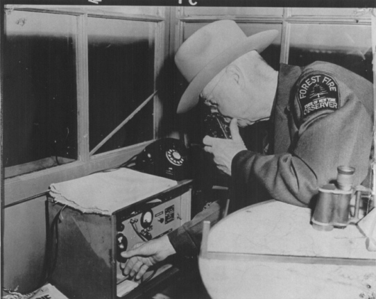
Pictured is Forest Fire Observer Bill Snell operating the radio on Flanders Hill.
|
Kings Park Fire Tower
Location: North of the community of Kings Park near the Meadow State Parkway interchange.
Status: Removed.
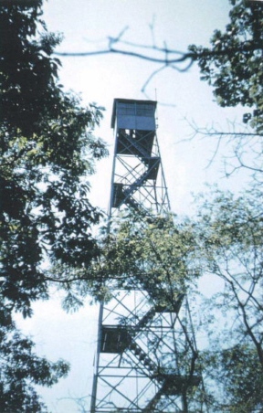
The tower was operated from 1948 until it was
closed in 1959 when the Conservation Department withdrew from active
participation in forest fire control activities on Long Island.
The structure at Kings Park was an 80' Aermotor LS40 tower erected by the Conservation Department in 1948.
The Long Island State Park Commission removed this
structure in 1960. The lower 47' portion is now used as an observation
platform at Oak Orchard Wildlife Management Area near Buffalo. Visitors
can still clearly see the words "NYSCD Kings Park LI" stenciled on some
of the steel pieces.
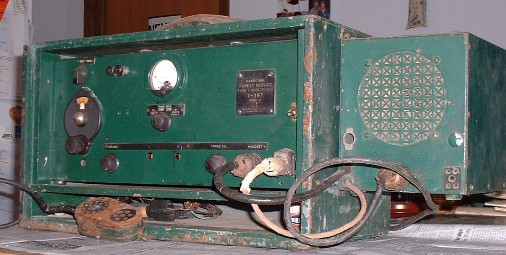
This 1939 vintage radio was the first used on King's Park and is now a part
of the NYS Forest Ranger Archives Collection.
 |
|
Oakdale Fire Tower
Location: What is now Connetquot River State Park, 1/4 mile northwest of the park headquarters.
Status: Removed.
Oak Dale was a site used only temporarily in 1921.
It was operated for only part of the 1921 season and reference to it
appears only in the table of active fire towers but nowhere in the text
or any other available documents.
However, an article in the Long Island Forum - July
1987 - entitled "The Fire Towers of Suffolk County" makes reference to
a 92' tower that once existed on the South Side Sportsman's Club, now
the Connetquot River State Park at Oak Dale.
The tower was used to release pheasants until a
state law was passed which prohibited the practice. Some say this
consisted of throwing or pushing the birds off the top of the tower so
that the so-called "sportsmen" on the ground could shoot them. One has
to question how sportsmanlike it is to take farm raised birds that have
never flown more than a few feet and "release" them from the top of a
100 foot tower. In 1922 the Club offered to donate the tower to the
Town of Islip, to be erected and operated as a forest fire observation
station.
Fire Warden Wohlfarth and District
Forest Ranger Clarence Dare requested that the Islip Board of
Supervisors accept the gift and authorize the moving of a tower, about
90 feet in height. This request was endorsed by Superintendent of
Forests William G Howard of the State Conservation Commission, who
expressed the opinion that the tower would be very valuable in helping
the fire wardens to locate and deal with incipient fires.
Superintendent Howard declared that the Town of Islip was far ahead of
most of the towns of the State in the matter of forest fire prevention
and urged that the good work be continued.
The tower was subsequently taken down
and divided into two unequal sections. A 70' section was erected behind
Wohlfarth's Gas Station on the Motor Parkway and Wheeler Road in
Central Islip.
This upper 20' portion of the Oakdale
Tower, unaccounted for until many years later, was erected a short
distance off an old dirt road just north of Motor Parkway about 1/4
mile east of Colonie Hill. All that now remains on site are some pieces
of twisted and rusted metal.
|
|
Stoney Hill Fire Tower
Location: Stoney Hill Road- 1 mile north of Amagansett
Status: Removed.
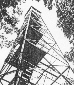 Stoney
Hill Tower, commonly referred to as Amagansett, was a standard 73'
Aermotor LS40 tower erected by the Conservation Department in 1930.
Funds for the purchase of this tower were provided by the Town of East
Hampton and by private subscription. This tower became operational in
1931. Stoney
Hill Tower, commonly referred to as Amagansett, was a standard 73'
Aermotor LS40 tower erected by the Conservation Department in 1930.
Funds for the purchase of this tower were provided by the Town of East
Hampton and by private subscription. This tower became operational in
1931.
The tower was closed in 1959 when the Conservation
Department withdrew from active participation in forest fire control
activities on Long Island.
This structure was dismantled and removed in 1960 by a local demolition contractor.
|
|
Telescope Hill Fire Tower
Location: Telescope Hill - 1 mile south of the Selden.
Status: Removed.
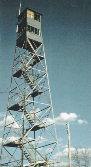 The
structure on Telescope Hill was a 60' Aermotor LS40 tower erected by
the Conservation Commission in 1918 and was operational in 1919. The
structure on Telescope Hill was a 60' Aermotor LS40 tower erected by
the Conservation Commission in 1918 and was operational in 1919.
As World War II began, an additional cab was
constructed within the tower framework and below the original cab. No
additional height was added to the tower. The original cab was used by
Civil Defense observers, while the lower, newly constructed, cab was
used for fire spotting.
The tower was closed in 1959 when the Conservation
Department withdrew from active participation in forest fire control
activities on Long Island.
This structure was dismantled and removed in 1960 by a local demolition contractor.
|


|
