 |

 |

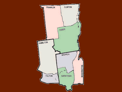 Click to enter. |


|
|
Lyon Mt. Fire Tower Location: 7 miles west of Dannemora.
The tower ceased operation at the end of the 1988 season. The tower was officially closed in early 1989 when the Department of Environmental Conservation determined that towers were no longer effective and decided to phase them out of service.
|
|
Palmer Hill Fire Tower Location: 2 miles north of the Hamlet of Au Sable Forks
With the advent of aerial detection, this tower was closed in early 1971 and was placed on the "Inactive" list but was reactivated in 1979. It was active until closing at the end of the 1988 season and was officially closed in early 1989 when the Department of Environmental Conservation determined that towers were no longer effective and decided to phase them out of service. The tower still remains, is on private property and is closed to the public.
|


|
|
Mt. Adams Fire Tower Location: 4 mile northeast of the Hamlet of Tahawus.
With the advent of aerial detection, the tower was closed at the end of the 1971 season. The tower and cabin are on lands previously owned by the National Lead Co.
In 2003, the Outdoor Space Institute (OSI) purchased about 10,000 acres of land from NL Industries. The area involved is commonly referred to as the Tahawus Tract. Within this acreage are the Mt. Adams Fire Tower, observer's cabin and related out buildings. As it was planned, a large portion of this property would be transferred to the State of New York and subsequently become part of the High Peaks Wilderness Area, requiring that the tower and related structures be removed.
Considerable pressure was brought, and the
involved parties, OSI and the DEC, arrived at an arrangement where the
surrounding lands would be transferred to the State with the exception
of the tower and cabin sites. These would be retained by OSI so that
historic preservation and restoration work could be commenced.
Restoration work was begun on the tower by the DEC through AmeriCorp volunteers of the Student Conservation Association. At this time, a "friends" group from ADKHighPeaks.com is doing restoration work on the tower. In early April 2006 the Adirondack Park Agency gave final approval to the plan for the Tahawus Tract. In view of this latest development, Mt. Adams should have a bright future.
The cabin on Adams, built in 1922, is the
oldest surviving in the state and one of the first of a standard design
established by the Conservation Commission that same year. The Friends
group began restoration work on the cabin in Sept. of 2007. Mt. Adams now appears on the National Historic Lookout Register.
|
|
Belfry Mt. Fire Tower Location: Near Mineville, 8 miles southwest of Westport.
The tower ceased operation at the end of the 1988 season. The tower was officially closed in early 1989 when the Department of Environmental Conservation determined that towers were no longer effective and decided to phase them out of service. The tower is on private lands and supports multiple radio antennas.
|
|
Boreas Mt. Fire Tower Location: 8 miles northwest of the Hamlet of North Hudson.
With the advent of aerial detection, this tower was closed at the end of the 1971 season and later removed.
|
|
Goodnow Mt. Fire Tower Location: South of Rt. 28N 2 miles west of Newcomb.
The structure on Goodnow Mt is a 60' Aermotor LS40 tower erected by the Conservation Commission in the early spring of 1922. The tower was closed at the end of the 1979 season. It was later transferred to the landowner, SUNY College of Forestry, Huntington Forest. The tower and cabin have been completely restored by the landowner and the tower is open to the public. Goodnow Mt. now appears on the National Historic Lookout Register.
|
|
Hurricane Mt. Fire Tower Location: North of Rt. 9N, 5 miles west of Elizabethtown.
The tower was closed about 1979. The tower was slated for removal in late 2001 or in 2002 as it was deemed a "non-conforming structure" in the Hurricane Mt. Primitive Area. However, the area has been reclassified and the fire tower is being restored. The Friends of Hurricane Mountain Fire Tower group is doing the restoration. Hurricane Mt. appears on the National Historic Lookout Register.
After a five year battle, on April 15, 2010 the Adirondack Park Agency has yielded to public pressure to allow both Hurricane and St. Regis Mountain Fire Towers to remain where they stand and amend the State Land Master Plan to recognize this decision. In addition, the Adirondack Council, who campaigned long and hard for their removal has indicated that it will not challenge the decision in the courts. To read of the decision click here.
|
|
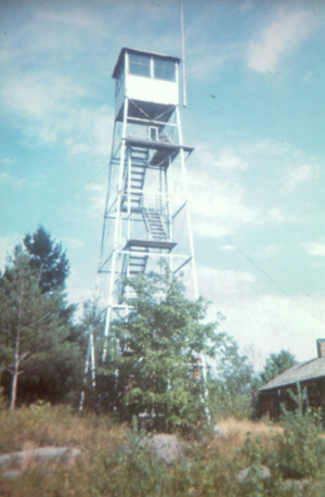
Makomis Mt. Fire Tower Location: 1 mile east of Underwood and near the intersection of I-87 and State Rt. 73.
A self-supporting staircase was developed by Aermotor, for installation in the towers purchased in 1916. This staircase amounted to a tower within a tower and was anchored to the original tower. These were purchased to replace the wooden stairs currently in use and were installed in this tower in 1933. With the advent of aerial detection, this tower was closed at the end of the 1970 season and later removed. In 2019, the fire tower was purchased by Mike Vilegi who restored it. Article
|


|
|
Pharaoh Mt. Fire Tower Location: 5 miles east of Schroon Lake in the Pharaoh Lake Wilderness Area.
There is no evidence that a tower was ever built on Pharaoh until 1918, when the Conservation Commission erected a 35' Aermotor LS40 tower. This tower was closed in 1987. This structure was later removed because it was irreparably damaged by vandals and was deemed excess to the fire detection needs of the Bureau of Forest Fire Control. The tower was then removed in 1992 because of vandalism (Click here to view a news article) and because it deemed a "non-conforming" structure in the Pharaoh Lakes Wilderness Area.
|
|
Poke-O-Moonshine Mt. Fire Tower Location: 7 miles south of Keeseville and west of I-87.
This made it possible for an inexperienced observer to locate fires more accurately than by using ordinary topographic maps. The Osborne was first tried out at Poke-O-Moonshine Mt. during that same year and a map was made. It was considered so successful that in the years to follow the Osborne was carried up to each mountain station and a map made. This project took several years to complete.
The inner portion was a topographic map with the tower location in the center. A sighting device called an "alidade" pivoted on a pin in the center of the map. Along the outer edge of the topographic map portion are azimuths that could be easily read by the observer once the alidade was sited on a possible fire. The outermost edge of the map is the panorama or a sketch of what the observer could actually see from the mountain station.
While these were very helpful to the observer in locating a possible fire, there was a downside to the concept.
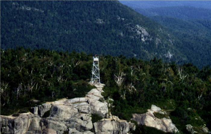
Vast areas of the Adirondacks and Catskills didn't appear on any stations maps requiring they use the previous methods of location. Triangulation, as a method of locating fires, didn't come in to its own until the 1940's. Years later, use of a 30 inch diameter map was instituted that effectively did away with this problem but created another. The panoramic sketches that were so helpful to the new observer had to go. This tower ceased operation at the end of the 1988 season. The tower was officially closed in early 1989 when the Department of Environmental Conservation determined that towers were no longer effective and decided to phase them out of service. In 1994, a group known as the Friends of Poke-O-Moonshine was formed to save and restore the tower. Poke-O-Moonshine appears on both the National Historic Lookout Register and the National Register of Historic Places, being placed on the latter on Sept 28, 2001.
|
|
Vanderwhacker Mt. Fire Tower Location: 4 miles west of Rt. 28 at Aiden Lair.
This tower ceased operation at the end of the 1988 season. The tower was officially closed in early 1989 when the Department of Environmental Conservation determined that towers were no longer effective and decided to phase them out of service.
|
|
Whiteface Mt. Fire Tower Location: East of Lake Placid.
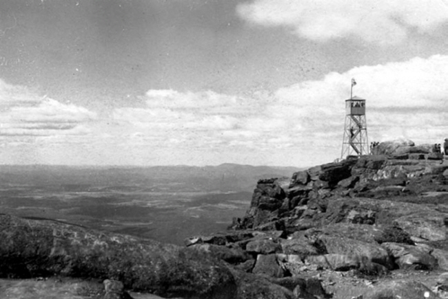
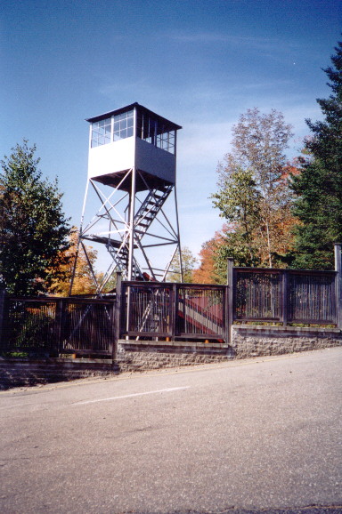
When this observation station was established in July 1909, no tower was immediately erected, as an unobstructed view was available due to the lack of tree cover on the mountaintop. All that was initially provided was a pole frame structure with a canvas tent stretched over it so that the observer could get in out of the weather. The shelter was later improved to a stone hut. Finally, in 1919, a steel 22' Aermotor tower was erected on the mountaintop. (Click here to view news article) In 1930, along with the memorial highway, a 46 foot memorial tower with a 60" revolving light was proposed to honor the Veterans of the World War. (Click here to view news article) As time passed the proposal grew to major proportions. It was finally proposed through the legislative process that the tower be of stone and be 70 feet tall. The authorizing legislation was ultimately vetoed by Governor Legman, putting the memorial tower idea to rest. (Click here to view news article) With the completion of the memorial highway, there followed a rather lengthy dispute over which agency, the Conservation Department or the State highway Department, would have control over the fire tower on Whiteface. Governor Lehman finally stepped in the ruled in favor of the Conservation Department in June of 1935. Following completion of the highway and the determination that there would be no memorial tower on Whiteface, the State completed the improvements on the mountaintop which included the Summit House and the tunnel and elevator in 1937. With the advent of aerial detection, this tower was closed at the end of the 1970 season. A year and a half later, on May 23, 1972, Whiteface was the first of many towers to be removed from Adirondack mountaintops. Some because they were deemed no longer necessary and others because they were considered "non-conforming structures" pursuant to the new Adirondack State Land Master Plan produced by the newly created Adirondack Park Agency. On that date, Forest Rangers and Operations personnel dismantled the tower marking the pieces for possible future use. Rangers and Operations personnel then loaded the shorter pieces into the elevator but the longer steel struts and leg sections were carried down the rocky path to waiting trucks at the end of the Memorial Highway. The tower's historical sign remained on the mountaintop for another year, when it was removed and eventually donated along with the tower to the Adirondack Museum at Blue Mt Lake where both remain on display to this day.
 |


|
|
Ampersand Mt. Fire Tower Location: South of State Rt. 3 between Saranac Lake and Tupper Lake.
|
|
Azure Mt. Fire Tower Location: 6 miles south of Santa Clara.
This tower was closed at the end of the 1979 season and now appears on both the National Historic Lookout Register and the National Register of Historic Places being placed on the latter September 28, 2001. An initial meeting of the of Azure Mt. Friends took place in November of 2001 to organize restoration of the facility. The tower has been completely restored and was officially "opened" on Sept. 27, 2003. A new map was also created and installed in the cab using the original metal supports.
|
|
Debar Mt. Fire Tower Location: 4 miles northeast of Meacham Lake.
|
|
Loon Lake Mt. Fire Tower Location: 4 miles west of Loon Lake and the Hamlet of the same name.
With the advent of aerial detection, this tower was closed at the end of the 1971 season. The tower is not open to the public. In 2010, the trail to the summit was opend by means of a Conservation Easement between the DEC and the landowner.
|
|
Meenahga Mt. Fire Tower Location: 7 miles north of Bloomingdale on the northwest side of Rainbow Lake.
The structure on Meenahga is a 73' Aermotor LS40 tower erected by Conservation Department Forest Ranger Albert Tebeau in 1927 for the Adirondack-Florida School. (Click here to view news article) Ranger Tebeau erected most of the fire observation stations in the northern Adirondacks. While it was primarily for the use of the School, the tower would be used as a fire observation station through an agreement between the School and the Department. The tower still remains on private land and is closed to the public.
|
|
Mt. Morris Fire Tower Location: South of the Village of Tupper Lake.
|
|
St. Regis Mt. Fire Tower Location: 4 miles south west of Paul Smiths.
In 1918 the State Conservation Commission
purchased a new device known as the Osborne Fire Finder. With this,
they developed new circular maps for each tower with a panoramic sketch
of the view from the tower around the outside perimeter. In the 1930's the Conservation Department experimented with two way radios to improve communications between its fire towers and forest rangers. The first radio ever used on St. Regis Mt. is pictured here. This should not be confused with a radio that is similar in make to the one first used, for this is the actual radio once used on St. Regis Mountain. St. Regis Mt. Fire Tower appears on both the National Historic Lookout Register and the National Register of History Places being placed on the latter in 2005. This development is viewed positively by the supporters of preserving the site. A "friends" group has been formed and is headed up by David Petrelli who can be contacted by clicking here or you can read about their efforts to save and restore the tower by clicking here. St. Regis is one of the mountains included in the Fire Tower Challenge sponsored by the Glens Falls-Saratoga Chapter of the Adirondack Mountain Club (ADK). "To complete the Challenge and receive the official full-color patch, hikers must climb and document, by date, ascents of at least 23 fire tower summits: 18 of 23 Adirondack Park summits and all 5 Catskill Park summits."
|


|
|
Kane Mt. Fire Tower Location: 3 Miles north of the Village of Caroga Lake.
|


|
|
Blue Mt. Fire Tower Location: Northeast of the Hamlet of Blue Mt. Lake.
Blue was operational for 80 years and one of the longest operating towers in the State, second only to St. Regis which operated continuously for 81. During all those years there were four different cabins provided for the observer. The first was a log structure and the other three were of frame construction.
In the 1950's, the "Cold War" raged and the threat of nuclear annihilation was a serious concern. The USAF had developed a long range radar system to protect against enemy bombers. In addition, they developed and deployed what where known as gap-filler radar stations. Having a range of around sixty-five miles, these radar installations were placed in areas where it was thought enemy aircraft could fly low to avoid detection by the longer-range radars of the permanent and mobile radar networks. One such gap-filler radio station was installed on the summit of Blue Mountain. The station became operational in January of 1959 and was decommissioned in December 1967. 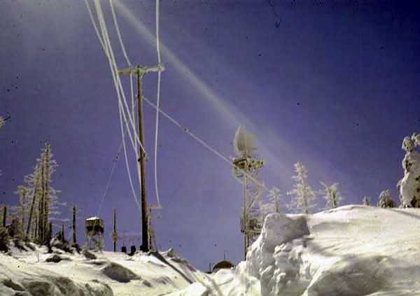 In 1992, the Blue Mt tower and cabin were seriously vandalized by unknown individuals. This occurred about the same time Pharaoh was toppled and some believe it may have been done by the same people. (Click here to view a news article) Blue Mt. has been adopted and restored by local volunteers. FFLA, Team Rubicon, and NYS DEC did significant work on the tower in 2019. |
|
Buck Mt. Fire Tower
Location: miles south of Tupper Lake and is west of State Rt. 30
The structure still remains on lands currently owned by International Paper Company, who signed an agreement on April 11, 2006 to sell all its holdings in the Adirondack Park to Lyme Timber Company for $137 million dollars.
|
|
Cathead Mt. Fire Tower Location: 7 miles northwest of Northville.
In 1916, the Conservation Commission replaced the wooden tower with a 50' Aermotor LL25 tower. It was of a lighter weight than their 1917 design and had no stairs but only a ladder up the exterior for the purpose of ingress and egress. Wooden steps were added within the structure to ease access for both the Observer and the general public in 1918 or 1919. (Click here to view a news article)
Access to Cathead is closed to the public because of a dispute between the Department of Environmental Conservation and a private landowner. In order to comply with APA policy, which prohibits the placement of any additional towers within the Park, a tower frame was constructed over and attached to the current tower to provide space for radio repeaters and their antennas for various governmental agencies.
|
|
Dun Brook Mt. Fire Tower Location: 6 miles northeast of Blue Mt. Lake. The only structure on Dunn Brook Mt was a wooden tower constructed by the Conservation Commission in May 1911. This tower was closed in 1920. There are no photos or other information to be had on this site.
|
|
Hamilton Mt. Fire Tower Location: 5 miles southeast of Lake Pleasant.
Wooden steps were added within the structure to ease access for both the Observer and the general public in 1918 or 1919. These were later replaced with a steel staircase with wood treads as shown in the adjoining picture.
With the advent of aerial detection, this tower was closed at the end of the 1971 season. This structure was removed about 1977 because it was deemed excess to the fire detection needs of the Bureau of Forest Fire Control and additionally was classified as a "non-conforming structure" in the newly established Silver Lake Wilderness Area.
|
|
Kempshall Mt. Fire Tower Location: 5 miles northeast of the Village of Long Lake.
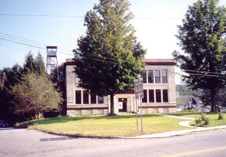
With the advent of aerial detection, this tower was closed at the end of the 1971 season. This structure was removed because it was deemed excess to the fire detection needs of the Bureau of Forest Fire Control and additionally was classified as a "non-conforming structure" in the newly established High Peaks Wilderness Area. This tower has been removed. Portions of this tower and the West Mt tower were used to erect the tower that now stands at the Essex County Historical Museum in Elizabethtown NY.
|
|
Owls Head Mt. Fire Tower Location: 4 miles southwest of the Village of Long Lake.
The tower is restored and is open to the public. It was added to the National Historic Lookout Register in 2006.
|


|
|
Pillsbury Mt. Fire Tower Location: 9 miles northwest of Speculator.
This tower was closed about 1985. It still remains and can be accessed by the public. Pillsbury Mt. now appears on the National Historic Lookout Register.
Pillsbury has been adopted by a local chapter
of the Forest Fire Lookout Association. In 2019, they did restoration work on the tower and expect to complete the work in 2020.
|
|
Salmon Lake Mt. Fire Tower Location: 10 miles north of the Village of Raquette Lake.
The tower had no stairs but only a ladder up the exterior of the structure for the purposes of ingress and egress. The structure still remains, is in poor condition and is not open to the public. Hours of intensive searching of numerous Internet sites relating to fire towers and forest fire prevention on both the state and national levels, as well as the National Historic Lookout Register and the National Register of Historic Places, revealed that the structure on Salmon Lake Mt. is quite likely one of only a few remaining Aermotor LX24 design towers still standing in the United States. Perhaps it is once again time to approach the landowner regarding restoring the tower before it is lost forever. |
|
Snowy Mt. Fire Tower Location: 7 miles southwest of Indian Lake and west of State Rt. 30.
With the advent of aerial detection, this tower was closed at the end of the 1971 season. The tower appears on the National Register of Historic Places, being placed there Sept 23, 2001. The DEC and local volunteers restored the tower in 2001. FFLA has an agreement with NYS DEC to maintain the tower. Below, to the left, is a great vintage
photo of Observer Alvin Mattison from the collection of Dan Locke. To
the right is a postcard generated from the Locke photo. Postcards can
be a great research tool as, in the instance of fire towers, most are
made from actual photographs, even in the early 1900s.
|
|
T Lake Mt. Fire Tower Location: 3 miles northwest of Piseco Lake.
With the advent of aerial detection, this tower was closed at the end of the 1970 season. This structure was removed because it was deemed excess to the fire detection needs of the Bureau of Forest Fire Control and additionally was classified as a "non-conforming use" in the newly established West Canada Lakes Wilderness Area. In 1977 the U. S. Army engineers were allowed to test shaped explosive charges on the fire tower which brought the tower crashing down. Within a few weeks the remains of the tower were flown out by helicopter. 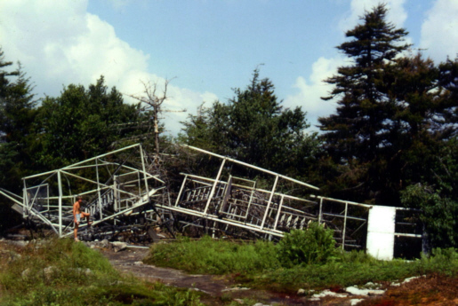 Residents of Piseco Lake made several unsuccessful attempts pleas to then DEC Commissioner Peter A. A. Berle to obtain the tower for air traffic control purposes at the Piseco Airport.
|
|
Tomany Mt. Fire Tower Location: 4 miles northwest of Arietta and west of State Rt. 30.
A self-supporting staircase was developed by Aermotor, for installation in the towers purchased in 1916. This staircase amounted to a tower within a tower and was anchored to the original tower. These were purchased to replace the wooden stairs currently in use and were installed in this tower in 1929, the same year the three photos appearing above were taken.
With the advent of aerial detection, this tower was closed at the end of the 1970 season. This tower was later dismantled and the pieces scattered near the summit.
|
|
Wakely Mt. Fire Tower Location: 12 miles southwest of Indian Lake.
Wooden steps were added within the structure to ease access for both the Observer and the general public in 1918 or 1919. (Click here to view a news article) A self-supporting staircase was developed by Aermotor, for installation in the towers purchased in 1916. This staircase amounted to a tower within a tower and was anchored to the original tower. These were purchased to replace the wooden stairs currently in use and were installed in this tower.
FFLA has an agreement with NYS DEC to maintain this tower. |
|
West Mt. Fire Tower Location: 4 miles north of Raquette Lake in the Pigeon Lake Wilderness area.
In 1920 it was replaced with a 47' Aermotor LS40 tower by the Conservation Commission. To move the steel from the railroad station in the Hamlet of Raquette Lake to the tower site the Commission hired a local woodsman and guide Billy Payne and his ox Tommy for the job. 
With the advent of aerial detection, this tower was closed at the end of the 1970 season. This structure was removed because it was deemed excess to the fire detection needs of the Bureau of Forest Fire Control and additionally was classified as a "non-conforming use" in the newly established Pigeon Lake Wilderness Area. Portions of this tower and the Kempshall Mt. tower were used to erect the tower that now stands at the Essex County Historical Museum in Elizabethtown NY. |


|
|
Cornell Hill Fire Tower Location: 2 1/2 miles east of Malta on US Route 9.
The structure on Cornell Hill is a 60' Aermotor LS40 tower erected by the Conservation Commission in 1923 and was operational in 1924. Of historical importance, the observer pictured, Noah LaCasse served as the observer on Cornell Hill from 1925 to 1934. In 1901 Mr. LaCasse was a guide in the party of then Vice President Theodore Roosevelt at the time he was hiking to Mt. Marcy when President McKinley was assassinated in Buffalo N. Y. With the advent of aerial detection, this tower was closed at the end of the 1970 season. The tower still remains on private land known as Luther Forest and now appears on the National Historic Lookout Register. In the summer of 2008, the Luther Forest Corporation dismantled and moved the tower to a new site on the former Boy Scout Camp Saratoga which is now a part of the Wilton Wildlife Refuge.
|
|
Hadley Mt. Fire Tower Location: 8 miles northwest of the Village of Lake Luzerne.
A self-supporting staircase was developed by Aermotor, for installation in the towers purchased in 1916. This staircase amounted to a tower within a tower and was anchored to the original tower. These were purchased to replace the wooden stairs currently in use and were installed in this tower in 1929. The tower was blown over during a hurricane in October 1919 but was quickly re-erected and back in operation for the 1920 season. During that same storm, Gore Mt. Tower was also blown down. This tower was closed August 24, 1990, being one of the last active fire towers in New York State. The tower has been restored by the Hadley Fire Tower Committee in the late 1990's and now appears on the National Historic Lookout Register and the National Register of Historic Places, being placed there in Sept 23, 2001.
|
|
Ohmer Mt. Fire Tower Location: 10 miles northeast of the Village of Northville. The only structure on Ohmer was a wooden tower erected by the Conservation Commission in October 1911. The tower was closed in 1916, as satisfactory arrangements could not be made for its continuance. A steel tower was constructed on Hadley Mt. in 1917 to replace Ohmer.
|
|
Spruce Mt. Fire Tower Location: 2 miles northwest of South Corinth.
The tower ceased operation at the end of the 1988 season. The tower was officially closed in early 1989 when the Department of Environmental Conservation determined that towers were no longer effective and decided to phase them out of service.
|


|
|
Crane Mt. Fire Tower Location: 6 miles south of Wevertown.
|
|
Gore Mt. Fire Tower Location: 4 miles west of the Village of North Creek.
This tower ceased operation at the end of the 1988 season. The tower was officially closed in early 1989 when the Department of Environmental Conservation determined that towers were no longer effective and decided to phase them out of service. The tower still remains and is used as a communications relay tower with numerous dish antennas attached to it.
|
|
Prospect Mt. Fire Tower Location: West of the Village of Lake George.
With the advent of aerial detection, this tower was closed at the end of the 1970 season and later removed.
|
|
Swede Mt. Fire Tower Location: South of State Rt. 8, 5 miles west of Hague.
With the advent of aerial detection, this tower was closed at the end of the 1970 season. The tower still remains on International Paper Company lands and is closed to the public. The tower and cabin are owned by Warren county. Plans are in place for restoration and to build a new trail. The target is to reopen to public access in 2020.
|


|
|
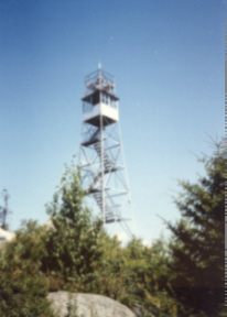
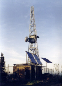
Black Mt. Fire Tower Location: East side of Lake George. The first structure on Black was a wooden tower constructed by the Conservation Commission in May 1911. In 1918, the Conservation Commission replaced the wooden tower with a 35' Aermotor LS40 tower. The tower ceased operation at the end of the 1988 season. The tower was officially closed in early 1989 when the Department of Environmental Conservation determined that towers were no longer effective and decided to phase them out of service. Black Mt. is currently being used as a radio repeater and relay site for various police agencies and the tower itself is closed to the public. However, excellent views of Lake George and the surrounding area can been seen from the area adjacent to the tower site. Of a truly historic nature, just north of the tower, is an etching or scratching on the rock that reads: "R. Rogers 1763". This was apparently done by Robert Rogers of the colonial era "Robert's Rangers". The marking has been deemed authentic by the New York State Education Department. The pictures below show the evolution of the Black Mt. Fire Tower from the days when it was simply a fire to tower, to when it served as an approach beacon for Glens Falls Airport to the present were it's used solely as a communications site and looks very similar to the monstrosity on Cathead Mt. 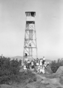
|
|
Colfax Mt. Fire Tower Location: 5 miles east of Greenwich and 4 miles not of Cambridge.
With the advent of aerial detection, this tower was closed at the end of the 1970 season. The tower still remains but is closed to the public.
|

 |